


|
|
|
|
|
 |
|
1.4 CLIMATE AND
PHYSICAL |
||
|
1.4.1 Auroville
has a tropical climate. The dry season usually lasts seven months, from
January to July. May and June are the hottest months with occasional showers.
The main rainy season is from October to January. The average rainfall
is 1,230 mm. a year. The prevailing wind blows from the southeast.
|
|
|||||
|
1.4.2 The central part of the designated Auroville township area is more than 50 m above mean sea level. The site slopes down from the centre to the periphery. The uncontrolled runoff appears to have been the main cause for the erosion of adjoining land. The deeper canyons are located mainly in the east and south of the designated area. There are a few water bodies or 'eris' in and around the township, of which Irumbai eri is the largest one. |
||||||
|
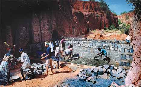
1.4.3 The geological structure of the area as indicated in Drawing 3, reveals that the topsoil is hard laterite on a bed of clay of varying depths. The soil is not suitable for productive agriculture with traditional methods. This was also assessed by the District Officer in 1976, who concluded that "the entire area is exposed to wind and water. If this is allowed to continue, then agriculture will be impossible…" The area also falls in the cyclonic belt. |
||||||
|
1.4.4 Pondicherry
city, with a population of about 4 lakh (1991), is the largest urban centre
at a distance of 6 km to its south while Tindivanam, the headquarter of
Tindivanam taluk with a population of over 60,000, is about 25 km to the
north-west. Cuddalore town, further south of Pondicherry, is another important
urban centre with a population of about 1.5 lakh. To the north of Auroville,
at a distance of about 10 km, lies the Kaliveli tank, a unique environmental
resource in the region. To the south is another major water body, the
Ustery tank, an important source for irrigation. There are about 40 villages
within the triangular area bounded by Pondicherry city, Tindivanam town
and Marakkanam with an entirely rural population of about 3 lakh. Thus,
Auroville's development is closely linked with the development of the
surrounding region. The development models evolved in Auroville township,
be it plantation, regeneration of land, water harvesting, building technology,
etc., are benefitting the entire region. |
|
|||||
|
1.4.5 The topography and climatic characteristics offered both constraints and opportunities for the development of a town like Auroville with its envisioned ideals. The constraints, in the form of gullied, windswept barren lands generally considered unsuitable for urban development, have been used as opportunities for evolving the form of the township. The slopes radiating from the centre to the periphery provided a suitable location for Matrimandir as the centre of the township and also the soul of Auroville. The geomorphology of the area also helped in conserving and optimally utilising the rainfall run-off to convert this inhospitable site into a hospitable environment for the development of a human settlement in harmony with nature. |
|
|