


|
|
|
|
|
|
|
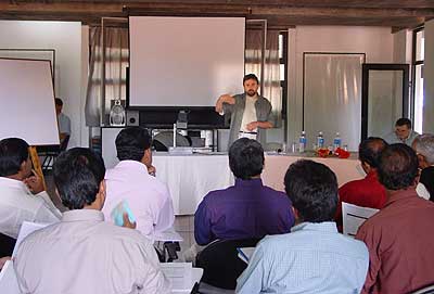
Centre for Urban Research, February 14th - 15th 2003 |
||||||
| >> PRESENTATIONS >> PROGRAMME SCHEDULE >> PARTICIPANTS LIST PRESENTATIONS
|
||||||
|
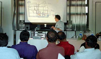
The presentation focused on the pre-feasibility study on water management made by the speakers as part of the Asia-urbs project IND-015 and on some other projects executed under his supervision in Germany and in developing countries. First he recounted his experience of a lake project in Berlin. He explained that the proposed lake had an overflow to recharge the ground water. To pump the water, solar and wind energy were made use of. From there the water would flow into an artificial river that feeds the lake, there a community house exists. This community house would be used for child care, weddings, training, festivals and social gatherings. This lake captured only rain water & has been operational since 1993. Only once, during unusually torrential rains the year before & there was a problem as it rained much more than the system was designed for and the pump failed. |
|
||||
|
|
|||||
Afterwards he made a presentation of the water management study done until then in the framework of the Asia-urbs project IND-015. He said that the site for Auroville, a city for 50,000 inhabitants, could not be built where a reliable water or food source did not exist. An interesting conclusion was drawn; the rainwater was the key! Rain in Auroville amounts to about 25 million cubic meters every year, sufficient for 50,000 people, therefore there is enough water even in a dry year. This is four times more water than Berlin in an average year. The problem was the storage of this water. |
||||||
|
Water kept in big lakes and ponds percolates and evaporates.
The cheapest & best storage is underground and the geology of Auroville
is favourable. There is a clay layer just beneath the Auroville premises
sliding down to the sea. The water that seeps into Auroville goes through
the city into the sea. But the best place to infiltrate the water is just
opposite the highest point: the Matrimandir Gardens. The water running off the streets would be dirty. Converting it to drinking water would be a long process. When drawn from the lake, the water is fit for drinking. If the system is good for Germany which has strict quality control, the same could be applied here in India. The final treatment of the dirty water should be pumped and passed through the lake, in the process getting purified and percolating into the ground. So before it leaves the city and flows into the sea, the water would be collected. |
|
||||
For example in the implementation of a 30 hectares settlement for 2000 people, the roofs would be connected to 4600 cubic meters of a common system of a row of houses and a places for private roads. All the houses would have their own systems ranging from small systems of 50 cubic meters to big systems of 300 cubic meters. All the roads would have surfaces from where the water could infiltrate into the ground and would be treated. The treatment can be done with root zone systems. |
|
|||||
An artificial basin is created and all the water flows by the gravity into the lake. For 3 years this would be Auroville landscape scenario with the lake completely sealed and only the overflow to be controlled. The lake would be only three and a half meters deep because the ground water exists and this water is crystal clear and only the storm water run-off goes into it. Then some slides were shown exhibiting the working of the system. Storage, infiltration, drains from the side of the roads to green corridors into the green belt. A mention was made of the use of surface drains, an idea that is practical and economical here in India. |
|
|||||
One slide showed an aerial view of the lake projected lake model where the roofs are visible, plants on top of the roof help to reduce the rainfall directly on top of the roof, and an under construction storage facility for storm water. Also visible is the inlet of the waste water into the green belt prior to the start of operation .The flow goes from here to the pond and from there to the households. The slides showed also plans for a treatment plant in Berlin, with storm water harvesting, artificial lake, wind mill, solar pump, the whole water course, the public house in the lake, the crystal clear water, storage, infiltration, green rooms, small and large infiltration basin with a capacity of 250 cubic metres. Some slides focused on an underground filter and pressure system, where one third of the whole area, all the systems of this are connected to this unit and from there we have the supplier filter that pressurizes the rain water. Surface rain water could be seen going through the pipes. The outflow, inflow and biological filters are also seen. One can also see a well filled with water works and the flooding test. The clarity of the water was also evident. |
|
|||||
|
|
||||||
Presentation by Astrid, Auroville on GIS use for water management
|
|
|||||
|
The GIS programme in Auroville was started two years ago,
with collaboration between various services and groups (town planning,
green belt & water). The GIS database is oriented from the regional
level, Kaluveli bioregion and down to local level, as in building site
plans. Some of its characteristics are as follows:
|
||||||
 |
Raw data is generated for the GIS in the following manner: Spatial database: |
|
||||
Non-Spatial:
|
|
|||||
|
The Use of GIS as a tool for Water Management
in the context of Urban Planning Auroville, consisting in many different settlements and residential areas, is presently concentrating on developing a Residential Area with five sectors. Intensive planning is undertaken in the Sector 1 and 2. Part of this was a comprehensive survey of the existing sectors 1 and 2 as a pilot project including a number of attributes such as population, vehicles, buildings and their use, facilities in the various areas and common utilities like electricity, water, telephone, etc. A standardized database was central in our approach. It enables us - data once incorporated in a GIS form- to link up a variety of information simply having one common ID (like e.g. neighbourhood ID, Name ID, Grid ID, etc), which can then be visualized in a map. GIS allowed us to work with spatial as well as non-spatial information at the same time. Display of thematic and street-based mapping systems along with the ability to analyze geographic locations and the information linked to those locations is combined. It is also dynamic, as updated information is linked up which automatically reflect those changes. Maps for presentations have been easily created. This tool has allowed Auroville to visualize and analyze information in a more open and easy manner. |
|
||||
| In the context of water management Astrid briefly explained two examples of our work that show how a GIS database can be integrated and help in quick analysis. The first of these two was demonstrated to non-technical residents of Auroville and the second to an expert panel as a part of decision support mechanism. |
|
|||||
Examples:
|
|
|||||
|
|
|||||
|
||||||
| Freshwater resources are decreasing both in quantity and quality the world-over and Pondicherry is no exception to this phenomenon. While Pondicherry depends entirely on groundwater resources for its supply of freshwater, this resource is threatened by over-extraction, pollution and salt water intrusion. One of the aquifers adjoining Pondicherry has gone saline as a result of over-extraction of groundwater and the subsequent intrusion of sea-water, and the other adjoining aquifer is in an advanced state of becoming so. |
|
|||||
As if the situation is not bad enough, industries around Pondicherry are letting out highly polluted and toxic effluents into the environment without any treatment whatsoever which directly or indirectly affects the quality of groundwater. In a few instances some industries violate all codes of law and ethics and pump their polluting effluents directly into the groundwater. It is in this context that the quest for obtaining and securing freshwater from alternative sources, such as through the harvesting of rainwater, has been attempted at the Sri Aurobindo Ashram Main Library. |
||||||
It may be said that all the freshwater that we have on earth has its origin in the atmosphere. It is only when this water precipitates, for example in the form of rain, dew or snow (not yet in the case of Pondicherry for the latter) that it is available to us as freshwater. We may use this water either when it collects in bodies of water situated either above (in lakes, tanks, rivers, etc.) or below the ground (in the subterranean aquifers), or by collecting it directly in appropriate structures as it falls. In this respect therefore we may consider that all the freshwater that is available to us is nothing else but rainwater than has been harvested someway or the other by nature and in some instances by man. |
|
|||||
In the past before the advent of pumps people depended entirely on freshwater available on the surface of the earth, e.g. from lakes, rivers, tanks, etc. It is only following the invention and widespread use of pumps that groundwater resources could be conveniently tapped. In fact, it became so convenient to obtain freshwater from groundwater that gradually the tradition and practice of using surface water dwindled. And as the link between rainwater and groundwater is not as obvious as it is with that of surface water, simultaneously the notion that the freshwater we use is in reality obtained from harvested rainwater also got lost. So much so, that today we talk of rainwater harvesting as though it is something that is as novel the development of the latest computer processors. |
|
|||||
The only novelty in rainwater harvesting today is the adaptation of this technique of harnessing freshwater to suit our modern day requirements and conditions. Traditionally, harvesting of rainwater by man was done in rural environments where plenty of land was available and where environmental conditions were conducive for this purpose. Today, the challenge is to adapt rainwater-harvesting techniques to suit urban conditions and requirements, where almost all factors work against the harvesting, conservation and use of freshwater. Our urban environments are congested, polluted and environmentally degraded. It is in these conditions that one has to artificially re-create and simulate the workings of nature to ensure that Nature's wonderful scheme of water supply is maintained intact so that it can sustain our human populations. |
|
|||||
| In this perspective therefore rainwater harvesting in our
urban environments becomes a means of ensuring that vital natural resources
and processes such as those related to the harnessing of freshwater are
maintained even in our artificial and un-natural urban environment. Thus,
rainwater harvesting does not become an alternative source of freshwater
supply only, but it fits in as an integral part of both the natural and
human water-cycle. |
||||||
|
|
|||||
| Freshwater demand: A water audit of the freshwater consumption and requirements at the library, has revealed that the library requires about 3,000 litres of freshwater per day from which about 500 litres are for potable purposes and 2,500 litres for non-potable purposes such as flushing of toilets, gardening, washing of open spaces, etc. If the 500 litres used for potable purposes could be obtained from harvested rainwater, and the remaining freshwater could be obtained from the groundwater then the library would become self-sufficient and would not need to depend on the municipal supply anymore. |
||||||
| Freshwater availability: The Sri Aurobindo Ashram Library building has a total plot area of about 1700 m2 of which 800 m2 or about 47% of the plot area consists of terraces from which relatively clean rainwater can be conveniently harvested. To begin with, the present rainwater harvesting system has been connected to a catchment (roof) area of approximately 200 m2 only from which about 2,00,000 litres of rainwater can be harvested during every year (with average rainfall). Initially a reduced catchment area has been provided as that is sufficient to supply 500 litres of water every day. |
|
|||||
| The rainwater harvesting system: The rainwater harvesting system that has been set-up at the library consists of five principal components:
Harvested rainwater from the storage tank shall be pumped to the existing
water tanks for consumption. |
|
|||||
|
Salient features:
|
|
|||||
| The rainwater harvesting system that has been set up at the
library has been designed by Harald Kraft and implemented by Kraft &
Associates, Pondicherry. This system is the first of its kind in India.
The above system was commissioned in the year 2001. Samples of water collected
from the rainwater storage tank (after having gone through the post-storage
treatment system) shortly after the tank had filled up fully with rainwater
at the end of the rainy season were found to be bacteriologically safe and
of potable quality.
|
|
|||||
PROGRAMME SCHEDULE |
|
|||||
 |
|
|||||
 |
|
|||||
| PARTICIPANTS LIST |
|
|||||
 |
|
|||||
 |
|
|||||
Auroville Participants |
|
|||||
 |
|
|||||
| The participants of the workshop | 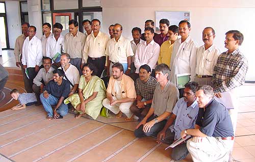 |
|